For Live Streaming of the Event Click Here

19-21 November 2024
International Science Workshop
on
High-Resolution Thermal Earth Observation
View Compendium

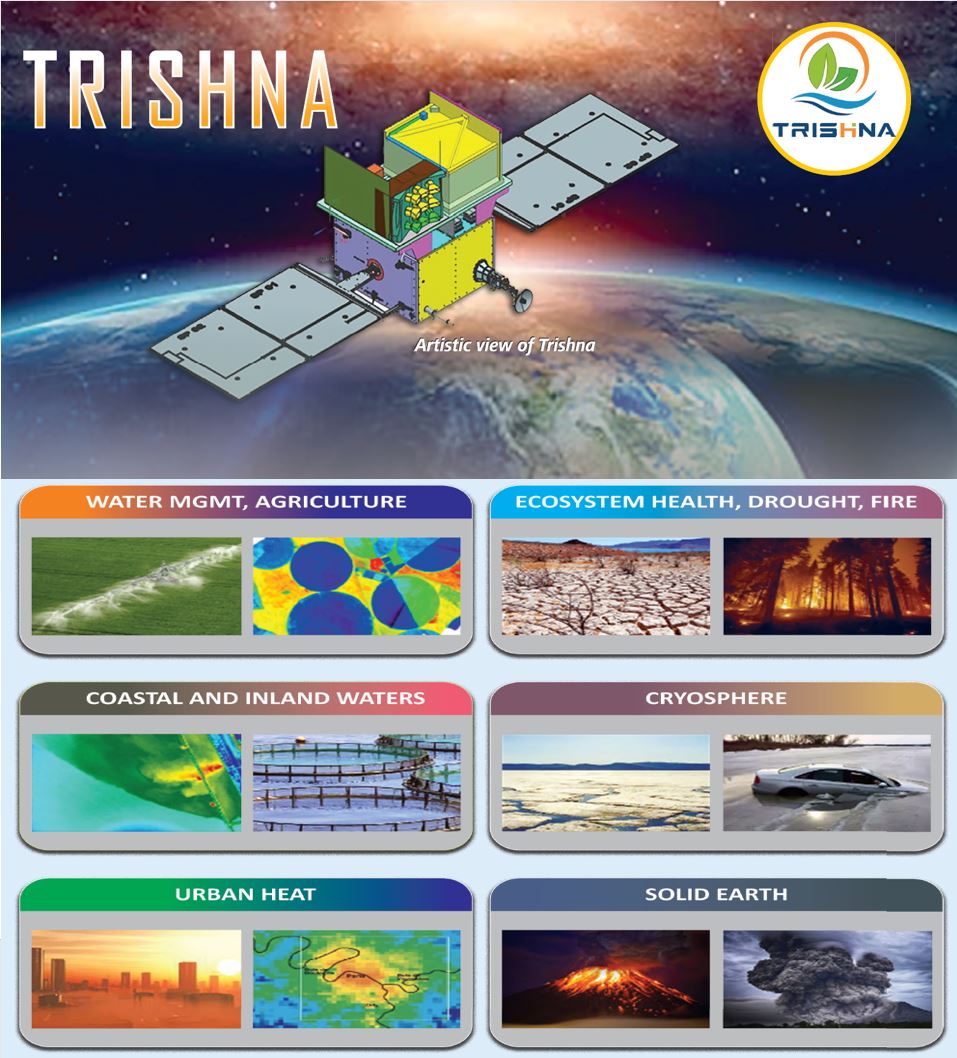
The Indian and French Space Agencies, ISRO and CNES, are jointly developing a state-of-the-art Thermal InfraRed (TIR) - Visible Shortwave InfraRed (VSWIR) Imaging Satellite mission, TRISHNA for high-resolution natural resources assessment and monitoring. The satellite is planned to be launched on-board Polar Satellite Launch Vehicle (PSLV) during 2026 for a duration of 5 years with possible extension of 2 years. The satellite will acquire data for the entire globe in four (4) TIR bands around noon and midnight times as well as in seven (7) VSWIR spectral bands. TRISHNA has a unique specification to offer a spatial resolution of 60 meters with a revisit period of 3 days at equator and more at higher latitudes to the global community. A primary objective of TRISHNA mission is to provide consistent and systematic records of surface temperature, in addition to several biophysical variables, to model the surface energy balance allowing to derive heat fluxes and estimate evapotranspiration. The need for high-resolution thermal observation has been recognized also internationally leading to complementary missions in preparation like Surface Biology and Geology (SBG) (NASA/ASI) and Land Surface Temperature Monitoring (LSTM) (ESA/EC). To reach out to the Indian and global science community and various user agencies/departments for awareness creation and larger involvement in the utilization of TRISHNA data and science products, a 3-day workshop is planned to be organized by ISRO during November 19 - 21, 2024. In preamble of the workshop, tutorials will be conducted on modelling tools for thermal radiative transfer, surface energy balance and evapotranspiration during November 17 - 18, 2024 at Ahmedabad.
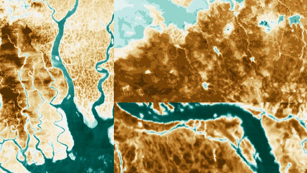
Prior to the workshop, two-day tutorial will be organized at SAC Bopal Technical Campus, Ahmedabad for students and young researchers during November 17-18, 2024 having experience in the field of remote sensing especially with thermal data and surface energy balance models. The tutorial will largely cover basics of thermal remote sensing, radiative transfer models, retrieval, surface energy balance and evapotranspiration modelling. The selection of candidates will be carried out by a designated committee. Faculties for this tutorial are eminent scientists from India and abroad. The detailed schedule of the tutorial will be announced later.
| Registration deadline for workshop | 30 September 2024 |
| Abstract submission deadline | 30 September 2024 |
| Registration deadline for pre-workshop tutorial | 7 October 2024 |
| Intimation of acceptance for pre-workshop tutorial | 15 October 2024 |
| Intimation of acceptance of abstract | 15 October 2024 |
| Presentation upload deadline for workshop | 11 November 2024 |
| Patron | ||
| 1 | S. Somanath | Chairman, ISRO & Secretary, Department of Space (DoS) |
| 2 | Philippe Baptiste | Chief Executive Officer, CNES |
| Co- Patron | ||
| 1 | N. M. Desai | Director, Space Applications Center (SAC), Ahmedabad |
| 2 | M. Sankaran | Director, URSC, Bengaluru |
| 3 | Shantanu Bhatawdekar | Scientific Secretary, ISRO, Bengaluru |
| 4 | Prakash Chauhan | Director, NRSC, Hyderabad |
| Scientific Advisory Committee | ||
| 1 | Thierry M. Carlier, CNES | Member |
| 2 | Philippe Maisongrande, CNES | Member |
| 3 | Philippe Gamet, CNES | Member |
| 4 | Jean-Louis Roujean, CESBIO | Member |
| 5 | Gilles Boulet, CESBIO | Member |
| 6 | Benjamin Koetz, ESA | Member |
| 7 | Simon J. Hook, JPL/NASA | Member |
| 8 | Ferran Gascon, ESA | Member |
| 9 | Charles E. Miller, NASA | Member |
| 10 | Steffen Dransfeld, ESA | Member |
| 11 | Bill Kustas, USDA | Member |
| 12 | Martha Anderson, USDA | Member |
| 13 | Kanishka Mallick, LIST | Member |
| 14 | Sekhar Muddu, IISC | Member |
| 15 | Rashmi Sharma, SAC | Member |
| 16 | A. M. Nagalakshmi, URSC | Member |
| 17 | D. Gowri Sankar, ISRO HQ | Member |
| 18 | J. V. Thomas, ISRO HQ | Member |
| 19 | S. Bandyopadhyay, ISRO HQ | Member |
| 20 | Mehul R Pandya, SAC | Member |
| 21 | Pravin K Gupta, SAC | Member |
| 22 | P. K. Thapliyal, SAC | Member |
| 23 | John Mathew, ISRO HQ | Member |
| 24 | K. Chandrasekar, NRSC | Member |
| 25 | R. Hebbar, NRSC | Member |
| 26 | Pramod Kumar, IIRS | Member |
| 27 | Bijay Handique, NESAC | Member |
| 28 | Neeraj Agarwal, SAC | Member |
| 29 | Bimal Kumar Bhattacharya , SAC | Convener |
Tuesday : 19 November, 2024
Wednesday : 20 November, 2024
Thursday : 21 November, 2024
Note:The final agenda and detailed programme schedule of pre-workshop tutorial and science workshop will be given one week before the event
| Sr.no | Hotel | Address | Website | Approx distance from SAC(km) |
|---|---|---|---|---|
| 1 | Hotel Novotel | Iscon Cross Roads, Sarkhej -Gandhinagar Hwy,next to Wide Angle Cinema,Ahmedabad,Gujarat 3800115 | Click here | 2 km |
| 2 | Hotel Crowne Plaza | Sarkhej- Gandhinagar Hwy,near Shapath V,Prahlad Nagar,Ahmedabad,Gujarat 380015 | Click here | 2 km |
| 3 | Hotel Courtyard Marriott | Ramdev Nagar Cross Road,Satellite Rd,Satellite,Ahmedabad,Gujarat 380015 | Click here | 0.5 km |
| 4 | Hotel Pride Plaza | Judges Bungalow Rd, off Sarkhej - Gandhinagar Highway,Bodakdev,Ahmedabad,Gujarat 380054 | Click here | 2 km |
| 5 | Hotel Holiday Inn Express | 1 Besides, Venus Atlantis, Plot No.38,Prahlad Nagar,Ahmedabad,Gujarat 380015 | Click here | 3 km |
| 6 | Hotel Suba Star | Judges Bungalow Rd,next to Akash Towers, Bodakdev,Ahmedabad,Gujarat 380015 | Click here | 2 km |
Note: Contact the Hotel for Accommodation. You may choose any other hotel in the areas of Prahlad Nagar, Satellite Area, SG Highway or Judges Bunglow Road. These areas are within 3 km of SAC.
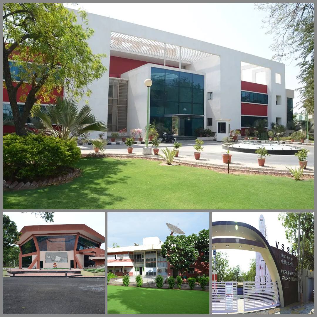
The Space Applications Centre (SAC) is a pivotal research and development arm of the Indian Space Research Organisation (ISRO), headquartered in Ahmedabad. Established in 1972, SAC has been instrumental in harnessing space technology for national development and societal benefit. SAC's core competency lies in designing and developing space-borne and airborne instruments, or payloads, for various applications. These payloads are essential components of satellites, collecting data for communication, navigation, and remote sensing purposes. In the realm of communication, SAC has developed transponders for INSAT and GSAT satellites, enabling services like VSAT, DTH, internet, broadcasting, and telephony. The centre is also at the forefront of India's navigation systems, developing payloads for IRNSS and GAGAN. The SAC is also responsible for designing and developing optical and microwave sensors for satellites. The data collected is processed into valuable information for applications in agriculture, environment, climate change, oceanography, and more. Beyond its research and development activities, SAC plays a crucial role in education and outreach. It conducts postgraduate diploma courses in satellite meteorology and communication and operates in-house and mobile exhibitions to popularize space technology.
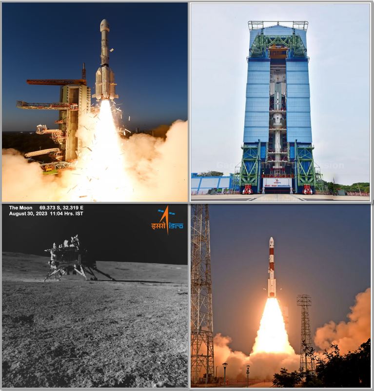
The Indian Space Research Organisation (ISRO) is India's premier space agency, responsible for the nation's space program. ISRO was founded in 1962 under the visionary leadership of Dr. Vikram Sarabhai. ISRO’s mission encompasses a wide spectrum of activities, including satellite design and development, launch vehicle technology, space exploration, and the application of space technology for national development. The organisation has achieved remarkable milestones, such as developing the PSLV and GSLV launch vehicles, successfully launching numerous satellites, and undertaking ambitious lunar and planetary missions. ISRO's contributions extend beyond space exploration. Its technologies have found applications in various sectors, including agriculture, disaster management, telecommunications, and meteorology. With a focus on self-reliance and innovation, ISRO has emerged as a global leader in space technology.
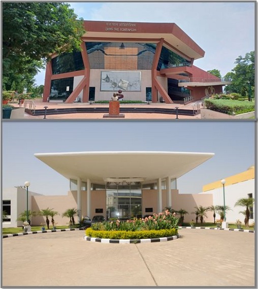
Science Workshop
International Science Workshop on High-Resolution Thermal Earth Observation will be held at Yashpal auditorium of Space Applications Centre (SAC), Ahmedabad, Gujarat, India. Space Applications Centre (SAC) is located at the heart of Ahmedabad city. Ahmedabad is well connected by road, rail and air. Nearest railway station Ahmedabad Junction (Kalupur) is approximately 10 km and Sardar Vallabhbhai Patel International Airport is approximately 15 km from SAC.
The Yashpal auditorium, at SAC, has sitting capacity for 500 persons and is well equipped with audio-visual facilities, lounge and conference room.
Pre-workshop tutorial
The pre-workshop tutorial will be conducted at Space Applications Centre (SAC), Bopal Technical Campus, Bopal, Ahmedabad (Opposite to Delhi Public School), Gujarat, India. This campus is approximately 9 km away from the main campus.
This campus hosts the training programmes related to Satellite Communication and Meteorology activities of the Centre for Space Science & Technology Education in Asia and the Pacific (CSSTE-AP) affiliated to the United Nations (UN).
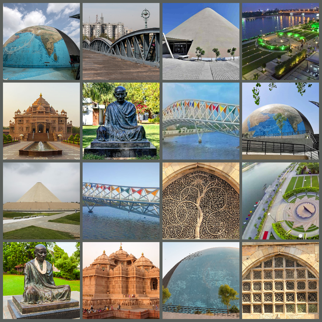
"Ahmedabad, a world heritage site and the largest city in Gujarat". It is located on the banks of
the River Sabarmati, 30km from the state capital Gandhinagar. The city is well connected with major
Indian cities by air, rail and road. Space Applications Centre (ISRO) is situated at the western part
of Ahmedabad city and can be reached by road from Ahmedabad airport (15km), railway station (10km) an
Interstate bus terminus (10km).The weather in Ahmedabad remains dry and warm during the month of
November
with temperature ranging from 20°C to maximum 32°C approximately. An exciting combination of
traditions and modernism,Ahmedabad captures all visitors with its diversity of places, religious and
ethnic communities. It is interesting to see how Indian atmosphere mix with the colonial British
influence, how Hinduism, the world's oldest existing religion develops in the globalising
world.
The graphic below shows the connectivity of the venue with airport (15
km) and railway
station (10 km). BRTS connectity exists till SAC gate.
